Flooding is the most common and costly natural disaster in the United States — and Ohio residents near rivers like the Ohio, Scioto, Hocking, and Muskingum face real flood risk. FEMA Flood Maps in Ohio: How to Read Them explained.
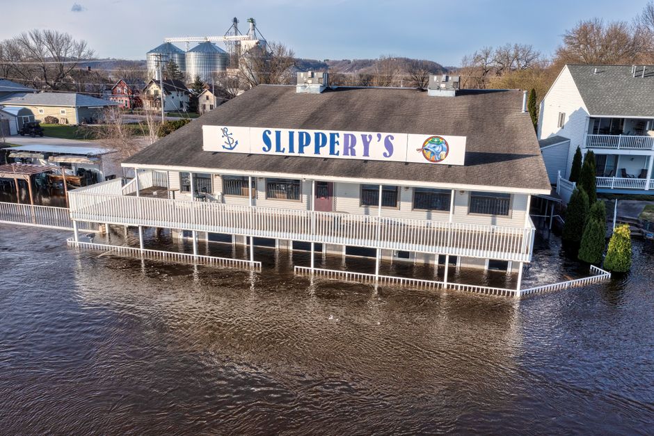
Does Standard Ohio Home Insurance Cover Flooding?
No. Standard homeowners and renters insurance policies explicitly exclude flood damage. Flood damage requires a separate policy through the National Flood Insurance Program (NFIP) or a private flood insurer.
Ohio Flood Risk Areas
- Ohio River corridor — Scioto, Lawrence, Gallia, Meigs counties
- Scioto River — flooding common through Portsmouth and Chillicothe
- Hocking River — significant flood history in Logan and Athens
- Muskingum River — flooding in Zanesville and surrounding areas
- Small streams and creeks — flash flooding common across rural Ohio

NFIP Flood Insurance Basics
- Available to property owners in NFIP-participating communities
- Maximum coverage: $250,000 for structure, $100,000 for contents
- 30-day waiting period (with exceptions) before coverage takes effect
- Rates based on FEMA flood zone designation and building elevation
- Ohio has over 800 NFIP-participating communities
NFIP Flood Insurance Average Costs in Ohio
| Zone | Risk Level | Est. Annual Premium |
|---|---|---|
| Zone X | Minimal | $400–$700 |
| Zone AE | High (100-year floodplain) | $800–$2,000 |
| Zone VE | Coastal high velocity | $1,500–$4,000+ |
Get a Free Quote Today
Jeff Smith State Farm can help you understand Ohio flood risk and connect you with flood insurance options to protect your home and belongings. Call (740) 354-7747 or contact Jeff Smith online for a no-obligation insurance review.
Understanding the Key Elements of a FEMA Flood Map

FEMA Flood Insurance Rate Maps (FIRMs) use a combination of color coding, letter designations, and boundary lines to communicate flood risk at the parcel level. The most important element for most Ohio homeowners is the flood zone designation for their specific property. Zone AE (shaded in blue or blue-gray on older maps) indicates the Special Flood Hazard Area — the 100-year floodplain where flood insurance is federally mandated for mortgaged properties.
The base flood elevation (BFE), shown as a number on the map near AE-zone boundaries, tells you the water elevation that flood waters are expected to reach during a 100-year event. If your home’s lowest floor is below the BFE for your area, you are at measurable risk of flood damage even in a relatively moderate event.
Effective Date and Map Revisions: Why Current Maps Matter
- FIRMs are updated periodically to reflect new engineering studies and development changes
- Many Ohio counties have received updated maps within the last 5–10 years
- Your property’s zone designation may have changed in a recent map revision
- LOMA (Letter of Map Amendment) — a process to remove a property from a flood zone if it was incorrectly included
- LOMR (Letter of Map Revision) — updates the official map based on physical changes like new levees or fill
How to Use FEMA Maps to Make Insurance Decisions

Knowing your flood zone helps you make two key decisions: whether to purchase flood insurance at all, and how much coverage to buy. Homeowners in Zone AE should carry flood insurance equal to the replacement value of their structure (up to the NFIP maximum of $250,000) and separate contents coverage. Homeowners in Zone X who choose to purchase coverage can often find affordable Preferred Risk Policies that provide meaningful protection at lower cost.
If you believe your property has been incorrectly placed in a high-risk flood zone, a licensed surveyor can produce an Elevation Certificate and help you apply for a Letter of Map Amendment (LOMA) through FEMA. A successful LOMA can eliminate the federally mandated flood insurance requirement for your mortgage and potentially reduce your premiums.
The FEMA Flood Map Service Center provides free access to current FIRMs for all Ohio counties — search by address to find your specific designation.
Learn more about determining your Ohio property’s flood zone, review the complete Ohio NFIP flood insurance guide, and contact Jeff Smith to discuss your FEMA map designation and flood insurance options.
Getting Ohio Flood Insurance Coverage Through Jeff Smith at State Farm
State Farm is a participating Write Your Own (WYO) carrier in the National Flood Insurance Program, which means Ohio homeowners can purchase NFIP-backed flood coverage through Jeff Smith’s Portsmouth office. Working with a local NFIP agent provides advantages over online flood insurance portals — you get personalized guidance on your specific flood zone, help interpreting your Elevation Certificate if you have one, and direct claims support when a flood event occurs.
Jeff Smith serves clients throughout Scioto County and the surrounding region — including communities in Lawrence, Gallia, Meigs, Pike, Ross, Athens, Hocking, Vinton, and Jackson counties. Southern Ohio’s network of river systems, including the Ohio, Scioto, Hocking, and their tributaries, creates flood risk for thousands of properties that benefit from NFIP coverage.
- NFIP flood insurance — federally backed, satisfies mandatory purchase requirements
- Building coverage up to $250,000 for the structure
- Contents coverage up to $100,000 for personal property
- Guidance on flood zone designation and Elevation Certificate interpretation
- Claims support after a flood event — direct access to your local agent
Talk to Jeff Smith About Ohio Flood Insurance
Ohio homeowners who want to understand their flood risk, verify their flood zone designation, or purchase NFIP flood insurance can contact Jeff Smith’s Portsmouth State Farm office directly. Jeff is a participating NFIP Write Your Own agent and can walk you through coverage options, waiting periods, Elevation Certificate considerations, and the annual cost of flood protection for your specific property.
Call (740) 354-7747 or use the contact form to reach Jeff Smith. You can also learn more about flood insurance in Ohio and homeowners insurance coverage through this site.